Stuart Bowling
A group of 5
us had a superb weekend on the rarely visited & untracked Loddon Range on
the weekend of the 5/6 March 2011.
This little
range is located to the west of the King William Range, south of the Lyell
Highway near Mt Arrowsmith and is the
last significant dolerite range before the Frenchmans Cap region.
Our departure point was a fairly arbitrary location on the Lyell Highway, descending steeply to the, thankfully, not too swollen, Surprise River. An icy wade across here led us uphill through fairly open forest to Eucryphia Lead, a long forested & in places scrubby spur leading up toward the lower summit of Ronald Cross.
Lunch on the tops & the views in all directions were simply spectacular, a cloudless blue bird sky greeting us after several days of snow during the week prior. Our designated camp site was originally to be Needle Rock Tarn, but soon after the summit of Ronald Cross we came across a flat, sheltered area with enough water to last us our short stay and access to spectacular views to the west, Frenchamns Cap in particular dominant.
After setting up camp here it was a long and often arduous traverse south along the Loddon range to the high point; we pretty much followed the broken dolerite ridge tops all the way along in a vain attempt to avoid the wiry alpine scrub which choked everything, particularly annoying as linking sections of rock & scree to gain pace was near impossible. Still, after 2 hours we reached both summits (6m height separating the 2 so we visited both) for amazing views to the Prince of Wales, Spires & King William Ranges and to the west the remote valleys of the Jane River & beyond to Frenchmans Cap. Just under 2 hours on the return leg saw us back at our little camp site just on dusk, exhausted after a 10 hourish day but treated to a beautiful clear sunset over the Cap to the west.
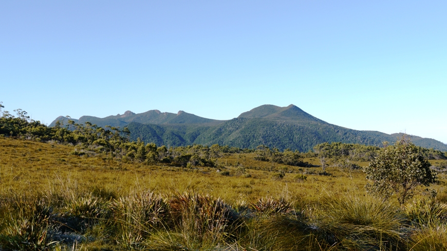 |
Mt Ronald
Cross (right) & the Loddon Range from the Lyell Highway - Eucryphia Lead to
the right.
|
 |
Looking south along the Loddon Range; Needle Rock Tarn
& King William Range in distance.
|
 |
Looking back (north) along the Loddon range; trickier
terrain than it looks, & scrubbier.
|
 |
A nice flat, sheltered camp site with water &
views - can't ask for much more!
|
 |
Crossing the
icy Surprise River
|
 |
| Looking south from Loddon Bluff to some very wild & remote country. |
 |
Lunch on the
tops; Mt Gell the prominence in the distance.
|
 |
Needle Rock, Slatters Peak & Lake King William.
|
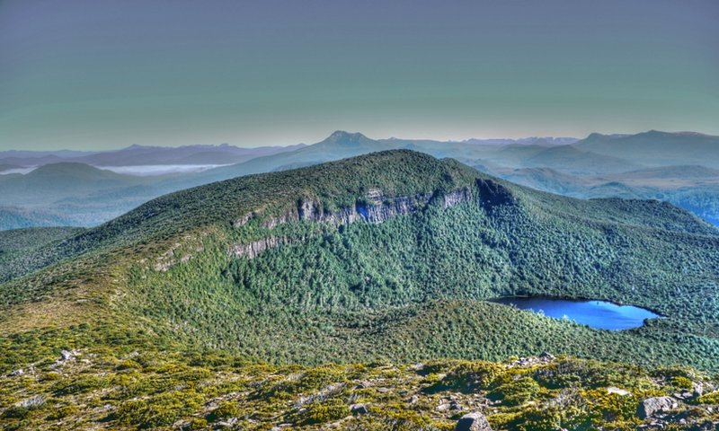 |
Ronald Cross & Scoparia Lake.
|
 |
Sunset over Frenchmans Cap.
|